Click HERE to jump directly to purchasing
options
Interactive Map to browse
our current products
Click the map to jump directly
to the interactive page.
|
Sidescan Sonar has been used
since 2003 to detect woody structure in some of the Bays on
the LBL side of the lake, plus other major embayments on Kentucky
and Barkley lakes. Big Sandy, Big Bear, Blood River, and Jonathan
creek. It has been an "eye opening" experience to learn where
structure exists and how much is commonly overlooked by both
shoreline and open-water fishermen.
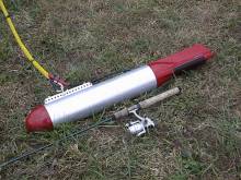
This is a picture
of the original Sidescan Sonar. It is 30" long and weighs
approximately 30 pounds.
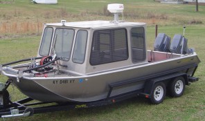
The new sonar
is twice as heavy and is capable of extremely detailed imagery.
The most significant improvements include a razor blade thin
sonar beam, towfish stability, extreme ping rates, and no
electrical noise whatsoever.
Below
are 2 stake beds or similar manmade structure. The square appearance
reveals a major clue that it is not a natural feature.
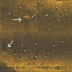
This
is a location in Big Sandy near a moderate slope into deeper
water. White dots have been placed on what is likely natural
stumps. I doubt that whoever placed the structure, knew there
were 30 (or more) other structural features less than 50 yards
away.
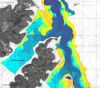
The
image above represents 0.9 acre. The width of the image is just
under 200 feet.

Above
is a submerged boat in Blood River. It is 14 feet in length.
Notice the sonic shadow of the boat on the bottom. Other unknown
structure exists off the front end of the boat. August 2004
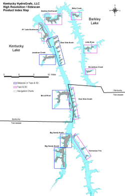
High
resolution topographic imagery is available for key areas in
Kentucky and Barkley Lakes