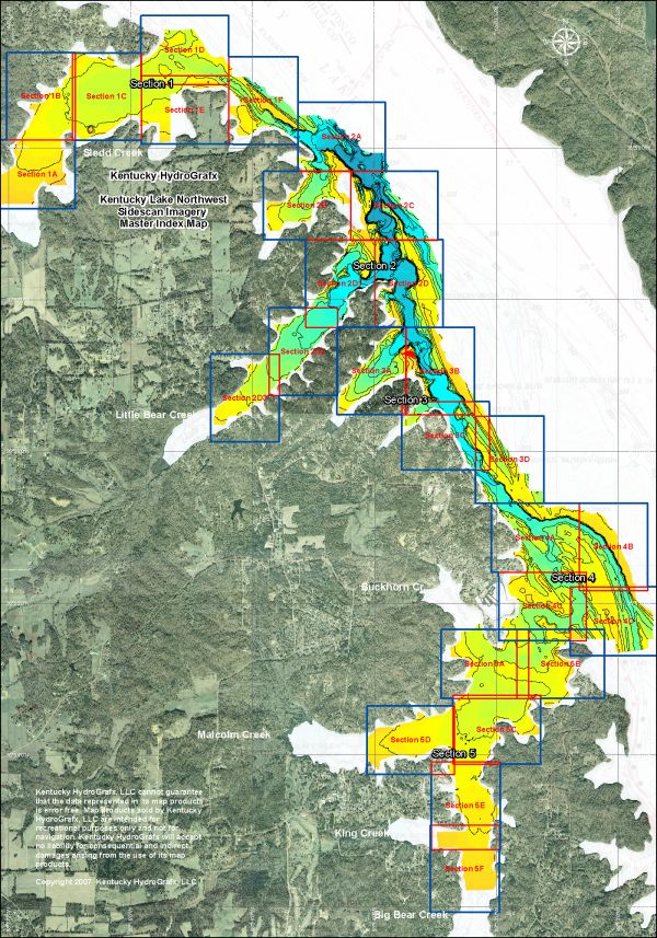
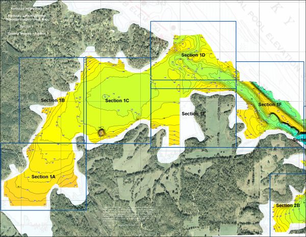
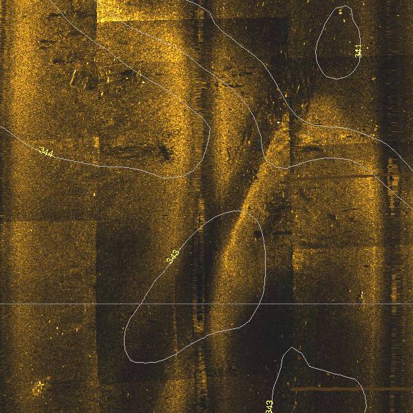
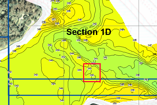
Site Index
Back to Product Page
Click for Price list and order information

KENTUCKY HYDROGRAFX, LLC

SIDESCAN Series
Kentucky Lake Northwest
Kentucky Lake (Kentucky)

This series of sidescan imagery covers 3000 acres near the north end of Kentucky Lake.
Use these images to program your GPS and go right to an ideal spot!

The set includes 27 Extreme resolution sidescan images, 5 Section Index topo
maps, and 1 Master Index map shown below.

For several examples of the sidescan data, see the supplemental images here!

Here is the Master Index map* for the new series. There are 5 major sections divided into a total of 27 extreme resolution sidescan maps.

This area includes the original topo coverage of the Kentucky Lake Northwest, plus an additional 1200 acres.

The total acreage of the area in color represents 3000 acres.


* Image resolution reduced to minimize download time.

All Sidescan imagery is georeferenced,
just like conventional HydroGrafx maps.

There are individual index maps for each Section. They are very useful for staying oriented in the extreme zoom levels of the Sidescan images, not to mention the topography.


This a zoomed out view of Sidescan section 1D. The sidescan information is not useable at this range, but this may help orient you to the full resolution example below.


This is a near full resolution sample of Section 1D. It is within the mouth of Sledd Creek bay.

This is a location in a subtle elevated ridge where an old roadbed crossed. The roadbed is cut into the ridge somewhat. There are several objects on each side of the roadbed. The square object might be a remnant foundation of a small outbuilding. It is 15 x 15 feet square.

The roadbed crosses the ridge at an approximate elevation of 344, which would be 15 feet deep at Summer pool (359.0).

Keep in mind, this 
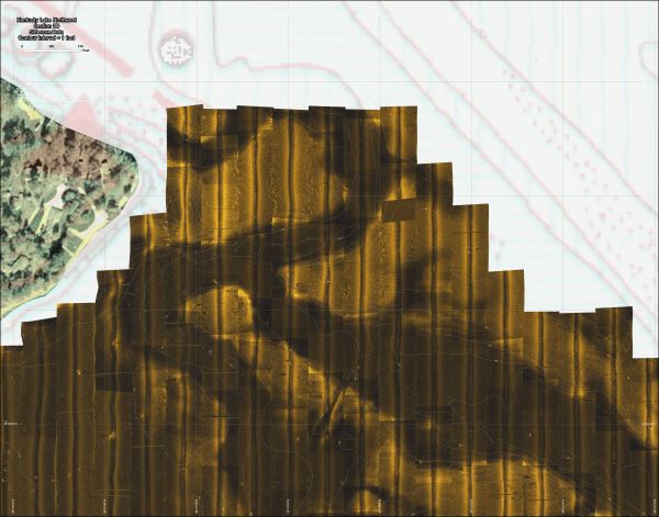
is just a small portion of Section 1D.

The dimensions of the image are approximately 380 x 380 feet or 3.3 acres.

The same area to the left is depicted on the index map below.

The contour interval on all sidescan imagery is 1 foot!


Here is a full resolution sample of the index map showing Section 4B. The area outlined in white is the same area of coverage as the Sidescan image above.

The contour interval on the Section Index maps is 2 feet.


More sample images of Kentucky Lake NW Sidescan

The Shareware version of OziExplorer mapping software is provided on the disk. The unregistered version will work great with Kentucky HydroGrafx imagery. The registration fee would NOT BE REQUIRED for using the key features of Ozi.

That means you can create waypoints, tracks, or routes that can be uploaded to most GPS units.


Other items included on the CD
(not shown here) include:

A very functional shareware version of OziExplorer GPS Mapping software is provided on disk to get you started with precision fishing. (The HydroGrafx images work flawlessly with this version.)

The portion of TVA Navigation Charts 1101 & 102 within the area of coverage.


Click Here to Purchase

Home Page

If you have any questions about this product, you can email us here pdghahs@kentuckyhydrografx.com

Copyright 2004 Kentucky HydroGrafx, LLC, A Kentucky Limited Liability Company.