Site Index
Back to Product Page
Click for Price list and order information

Back to main KY Lake NW SS page
KENTUCKY HYDROGRAFX, LLC

Additional Kentucky Lake Northwest SIDESCAN clips
Please be patient while this page loads

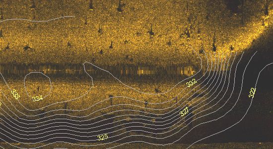
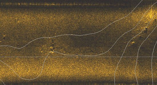
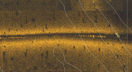
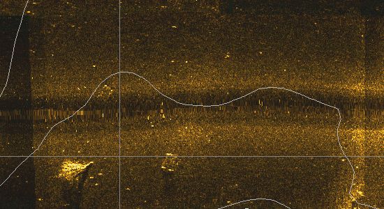
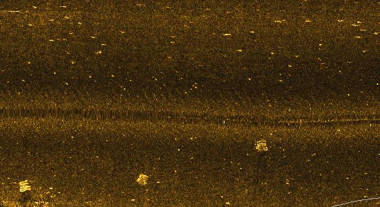
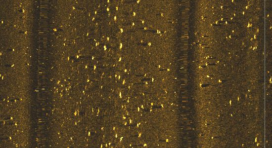
This is a clip from the Sledd Creek area. It represents a small portion of a huge stump field in Turpin Pond. It was surprising to see that many remnant stumps where most natural cover in lower flats is silted over.

We speculate that these are cypress stumps that are commonly cut off much higher in timber harvest activities due to the very wide bases.

The shadows confirms that the objects are directly attached to the bottom.


Here is a clip from Section 2A. This is a shelf approximately 25 feet deep at Summer pool.

Scattered structure. Probably natural stumps Other structure exists on very steep slope dropping into 37 foot water.


Here is a portion of a major hump in Little Bear Creek. Lots of structure at various elevations. Very likely all manmade structure with lots of stakebed/like objects on the right side.


Here are multiple stakebed type structure. The roughly square shape gives them away. There is lots of other "noise" in the image caused by fish. High fish densities make sidescan data interpretation challenging, but it's also the reason fishing success is so high.

I can see at least 10 objects I would fish here. Keep in mind, this is about 2 acres of area shown. The data set includes 3000.

If you look closely, you will see the sonic shadows a several small objects. they are in roughly a straight line. This is likely an old property line that was a row of trees.

This line actually shows on the TVA Navigation Chart 1101 as a row of dots.


Just a few good-sized objects in the middle of nowwhere in an area where the bottom contours are very gentle.

Notice how little fish noise in the image. Fish aren't always where you want them to be, but another day or time might be different.


Lots of random natural stumps on the top of a shelf in 15 feet of water at Summer Pool. This stumpfield is roughly northeast of Moors Resort.


I think you will see an obvious tree in the lower left corner. This is the result of the same tornado that demolished the area of campers at Moors Resort.

There wasn't as much debris showing on the sidescan as I would expect following such a destructive tornado adjacent to the lake.


Here are 3 stakebeds. They are way back in Bear Creek where the bottom substrate is very soft. This results in a very dark bottom representation.

Since the bottom return is so dark, sonic shadows are either very subtle or non-existent. Here the objects show up very well.

The random speckles and streaks are probably individual fish.


Back to main KYNW SS page

Click Here to Purchase

Home Page

If you have any questions about this product, you can email us here pdghahs@kentuckyhydrografx.com

Copyright 2005 Kentucky HydroGrafx, LLC, A Kentucky Limited Liability Company.