Index

Kentucky Lake Northwest
*released August 2003

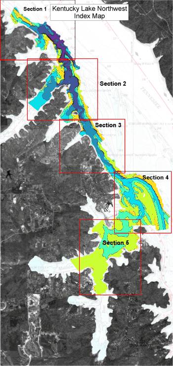
This is the index map for the new Kentucky Lake Northwest imagery.

The area in color is the portion of Kentucky Lake that has recently been re-mapped.

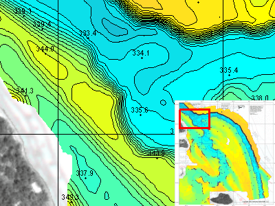
NEW depth data was collected from June 2003 - August 2003.

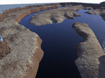
The new maps include portions of Bear, Malcom, and Buckhorn creek that then extend 5 miles north. A very impressive secondary channel makes up a large percentage of the imagery with all dynamic bay mouths well represented.

The high resolution imagery for Kentucky Lake Northwest is based on over 115,000 depth readings covering more than 1700 acres.

The area is divided into 5 sections. Topographic images for each section contain a contour interval 0.5 - 2.0 feet.

As you see here, the images are actually a hybrid image including the brand new data, plus background imagery of Charts 1101 & 102.

Also included in the background is aerial photography to help get oriented with real world features.

Topographic images on CD each contain a latitude and longitude grid and coordinates for easy calibration with GPS mapping software.

This is a high resolution sample from Section 4 just northeast of Moors Resort.

Latitude/Longitude grid lines are provide on the topo maps for easy calibration with GPS mapping software.

The contour interval in this sample is 1.0 feet. Map sections north of section 4 have a contour interval of 2.0 feet, while section 5 has an interval of 0.5 foot.

Hundreds of spot elevations are included for easy reference. If you know the current lake elevation, then water depth can be easily calculated.


The next step in 3d viewing has been included with all high resolution Kentucky Lake Southwest Images

Similar to the most recently released map imagery, the Kentucky Lake Northwest set includes the extremely popular "Fly-through" 3d models.

Each map section has it's own animated movie to help visualize the terrain below the water's surface.

This image is from section 4 and depicts the intersection of Bear Creek with a secondary channel that makes up a majority of this series. This image is a view to the southeast from the northwest corner of section 4.

While this is a still image, the product CD includes the animation.


Other images included on the CD (not shown here) for Kentucky Lake Northwest include:

Clip of navigation charts 1101 & 102 that encompass the area represented in this set.

A nice hybrid image of nav charts 1101 & 102 merged with surrounding aerial photography of the lake.

A DEMO version of OziExplorer GPS Mapping software is provided on disk to get you started with precision fishing. The HydroGrafx images work flawlessly with this version.


Click Here to Purchase

Click here to view the entire list of Kentucky HydroGrafx products

Home Page

If you have any questions about this product, you can email us here pdghahs@kentuckyhydrografx.com

Copyright 2003 Kentucky HydroGrafx, LLC, A Kentucky Limited Liability Company.