|
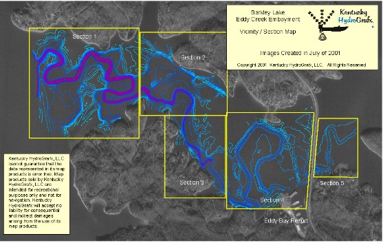
The area in blue on the left is the portion of Eddy Creek Embayment that has been re-mapped. NEW depth data was collected May-July of 2001.The bay is divided into 5 sections. Topographic images for each section contain a contour interval of 0.5 or 1.0 ft. |
Topographic images on CD each contain a latitude and longitude grid and coordinates for easy calibration with GPS mapping software.
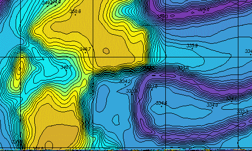 |
This is a sample from Section 1 near the mouth of the bay.Contour interval is 1.0 foot. Lots of spot elevations are included on all section maps for easy reference. |
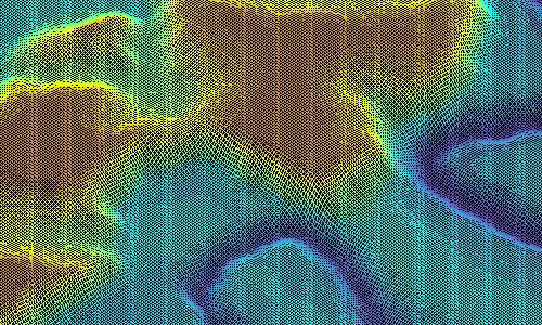 |
There are four 3 Dimensional wireframe images for each section map. The 3d images represent a perspective from NW, NE, SW, and SE for each individual section. |
Copyright 2001 Kentucky HydroGrafx, LLC, A Kentucky Limited Liability Company.