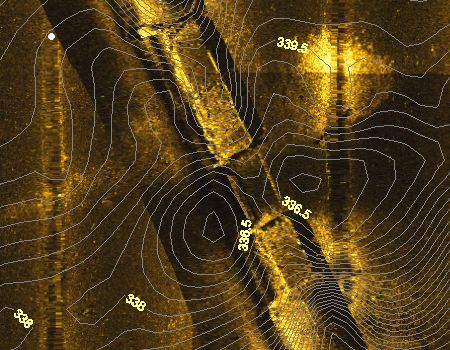
This is the location of an old bridge. The bridge surface is gone, but the cross supports still exist. The rectangular sections are likely concrete slabs of the old road.
Back
to main Jonathan page
KENTUCKY HYDROGRAFX, LLC
 |
This is the location of an old bridge. The bridge surface is gone, but the cross supports still exist. The rectangular sections are likely concrete slabs of the old road. |
 |
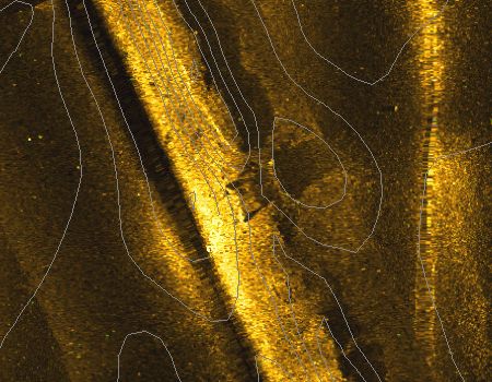
The is a portion of the roadbed that leads to the northwest from the bridge above. The structure in the center is likely an old concrete box culvert that existed under the road for drainage.
|
 |
Here is a rounded point in the middle of the bay. Lots of structure on the top as well as the sides. Most of this structure would be about 17-18 feet deep at a Summer pool level of 359.0. The contour interval here is 0.5 foot. |
|
|
Here is more structure on a point. This is a steeper ledge as indicated by the topo lines closer together. Generally shallower than the previous image above. |
|
|
Here is some structure in a silty flat. The spot just left and below of center are likely buckets. This is a popular type of manmade structure in Jonathan. More subtle but just as interesting are a few brush piles on the top edge of the image. |
|
|
Most won't know what this is. It is the Jonathan creek public boat ramp. The smooth rectangular shape on the right side (center) of the image is the ramp itself. The black area would be out of the water. If you look closely, you can see 3 or 4 linear reflections off the floats under the courtesy dock. North is up in all the images shown here. |
|
|
Here is a shoreline pass. The reflections in the upper right corner are the floats under a private boat dock. This is a very common thing in Jonathan given the number of private docks. Notice a few scattered structural features just off the shoreline. |
|
|
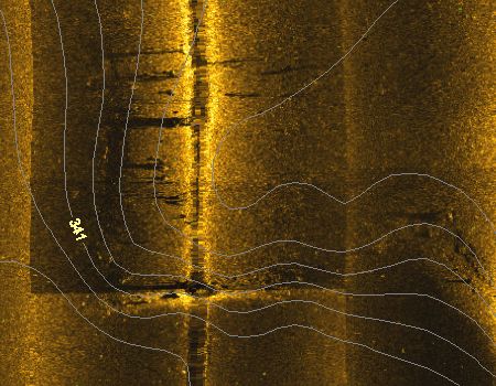
Here are a few natural stumps that exist along the original Jonathan Creek channel. This is not a common occurrence since most of the creek channel has silted in completely. |
Copyright 2005 Kentucky HydroGrafx, LLC, A Kentucky Limited Liability Company.