Index

Jonathan Creek Embayment of Kentucky Lake

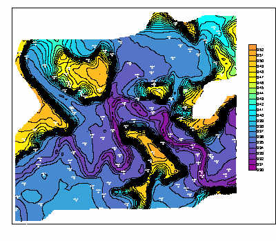
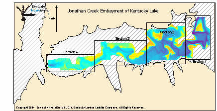
The area in color on the left is the portion of Jonathan Creek Embayment that has been re-mapped. NEW depth data was collected in January and February of 2001.

The bay is divided into 4 sections. Topographic images for each section contain a contour interval of 0.5 or 1 foot.

Topographic images on CD each contain a latitude and longitude grid and coordinates for easy calibration with GPS mapping software.

This is a low resolution sample from Section 2. Contour interval is 1.0 foot. Lots of spot elevations are included on all section maps for easy reference. A color elevation scale is also present on the topographic images.


There are four 3 Dimensional wireframe images for each section map (for a total of 16). The 3d images represent a perspective from NW, NE, SW, and SE for each individual section.

Click Here to Purchase

Click here to see Blood River

A DEMO version of OziExplorer GPS Mapping software is provided to get you started with precision fishing.

Copyright 2001 Kentucky HydroGrafx, LLC, A Kentucky Limited Liability Company.