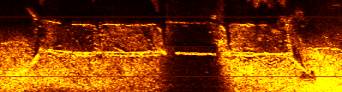
Kentucky HydroGrafx -- Sidescan Sonar Imagery

We are in the data acquisition phase for the new sidescan sonar imagery. We have made a couple of trips already to look at unique lake features. We visited Jonathan Creek to test scan a known roadbed and bridge crossing. This images below represent those areas

This is a sidescan image of a submerged bridge approach. The creek shows as dark brown/black. Notice, the actual bridge surface is gone, but the cross beams still exist.


This image represents a more realistic scale of what Kentucky HydroGrafx will provide in the upcoming products. The area shown to the left is approximately 5 acres. Sidescan imagery will be provided on very large scales. For example, it is likely that 2500 acres or more will be scanned in Blood River alone.
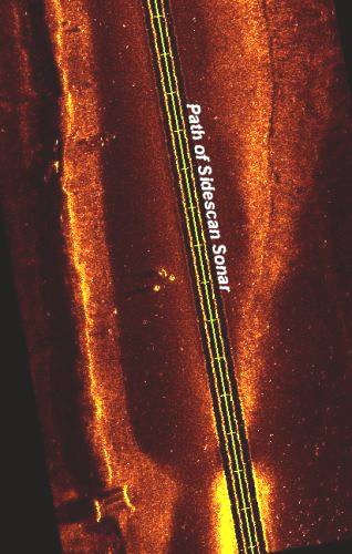
This image 
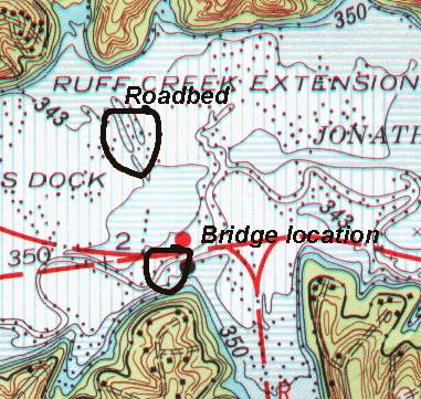
is a sidescan of a known roadbed that runs roughly northwest 
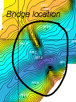
from the bridge (shown above). The major roadbed is on the left side of the screen. Another roadbed (much less distinct) show on the right side.

Structural objects usually show up as brighter returns, plus they will typically cast a shadow. Many times, the "shadows" are as important since they give clues to the height and detail of the object.

Notice the very distinct objects just to the left of the word "sonar". See the shadows!

If you look closely, you can see other objects along the base of the roadbed.

The most prominent feature is on the south end of the roadbed. We believe it was where a culvert crossed below the roadbed and the 2 objects are end support structures.


Here is a portion of TVA chart 102 that includes Jonathan Creek. The sidescan test areas are circled and identified.

The "bridge location" was re-mapped by Kentucky HydroGrafx a couple of years ago and it is included in the topographic imagery already available.

The roadbed location was not included in the initial zone of coverage for the current Jonathan creek product.

This image to the right is the same bridge location shown above, but from the topographic imagery currently available for Jonathan creek.

**Note*** the sidescan bridge image above is rotated for best viewing. It is actually oriented to the northwest as depicted in the image to the right.

While the sidescan imagery will be done on a large scale, very unique features will be given special attention and provided along with the large scale products. Unique features that may demand additional attention include roadbeds, bridges, dynamic ledge features, cars, boats, etc.

Who knows what kind of objects will be found under the waters surface.