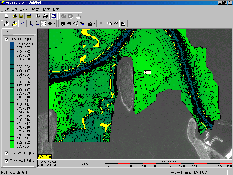
This is a screenshot of ArcExplorer. The DOQQ aerial photography was used as a background (Notice Barkley SRP Marina in the lower right corner) with a sample section of Little River Data shown in shades of blue and green. Everything showing in yellow is between the 339 and 340 contour lines. Another handy item is a scalebar at the bottom of the image.
An identify feature is also available. As you move the mouse cursor around, the elevation value of that area will show in a small rectangle (As the 352 number shows here).